
Surveyed.Critec 360 brings drone-LiDAR, Gaussian splatting and engineered site plans together into one digital twin you can measure, design against and audit — so every security decision is made on the real site, not a guess at it.
Trusted by operators of the systems we all rely on
— drag to explore


Capture. Model. Verify.
Step 01 of 03
Capture.
Survey the site exactly as it stands.
A short, low-disruption visit puts a multi-sensor rig over the compound — drone and SLAM LiDAR building a millimetre-true point cloud of perimeter, buildings and rooftop, in daylight or full dark.
- Drone & SLAM LiDAR in one mobilisation
- Millimetre-true, georeferenced point cloud
- Reaches live, restricted and hazardous areas
- No external light needed — it carries its own
Step 02 of 03
Model.
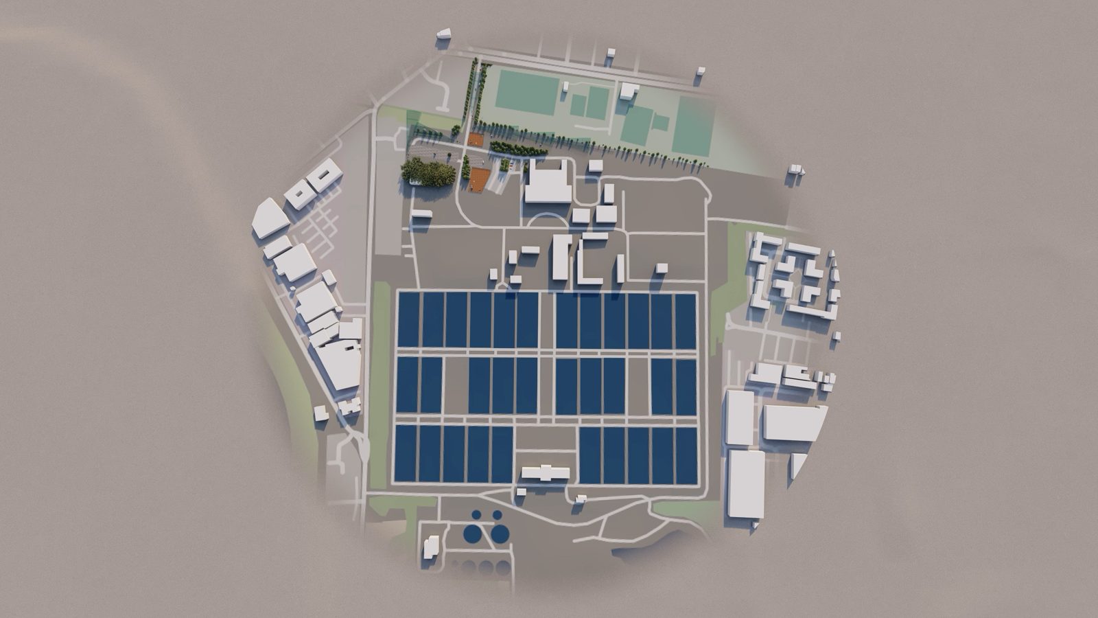
Turn the capture into a working twin.
The cloud becomes a photoreal Gaussian-splat model with engineered site-plan layers registered on top — boundary, buried services and the security design — that anyone can open, measure and mark up in a browser.
- Photoreal Gaussian-splat reality model
- Engineered boundary, utility & security layers
- Toggle each discipline on or off
- Measure, annotate and take off on screen
Step 03 of 03
Verify.
Design the coverage — then prove it on site.
Place cameras and detection lines against the real geometry to a measurable pixel-density target, check the design as-built in on-site AR, and roll the findings into a costed, branded report.
- CCTV viewshed & coverage to BS EN 62676-4
- As-built vs as-designed clash checks
- Walk the finished scheme on site in AR
- Costed, branded report in a click
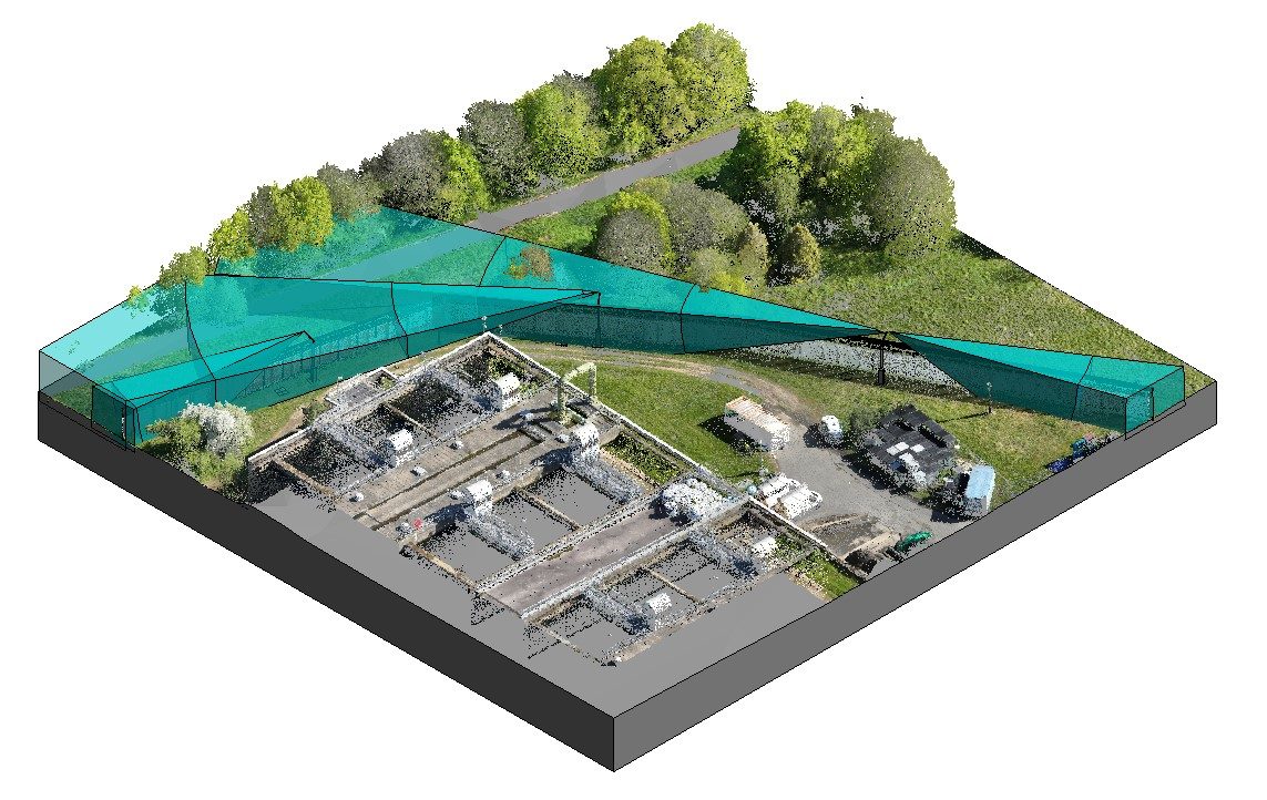
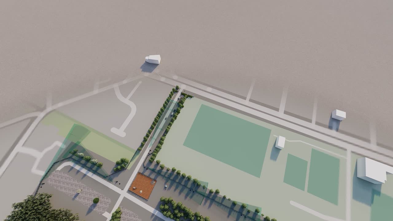
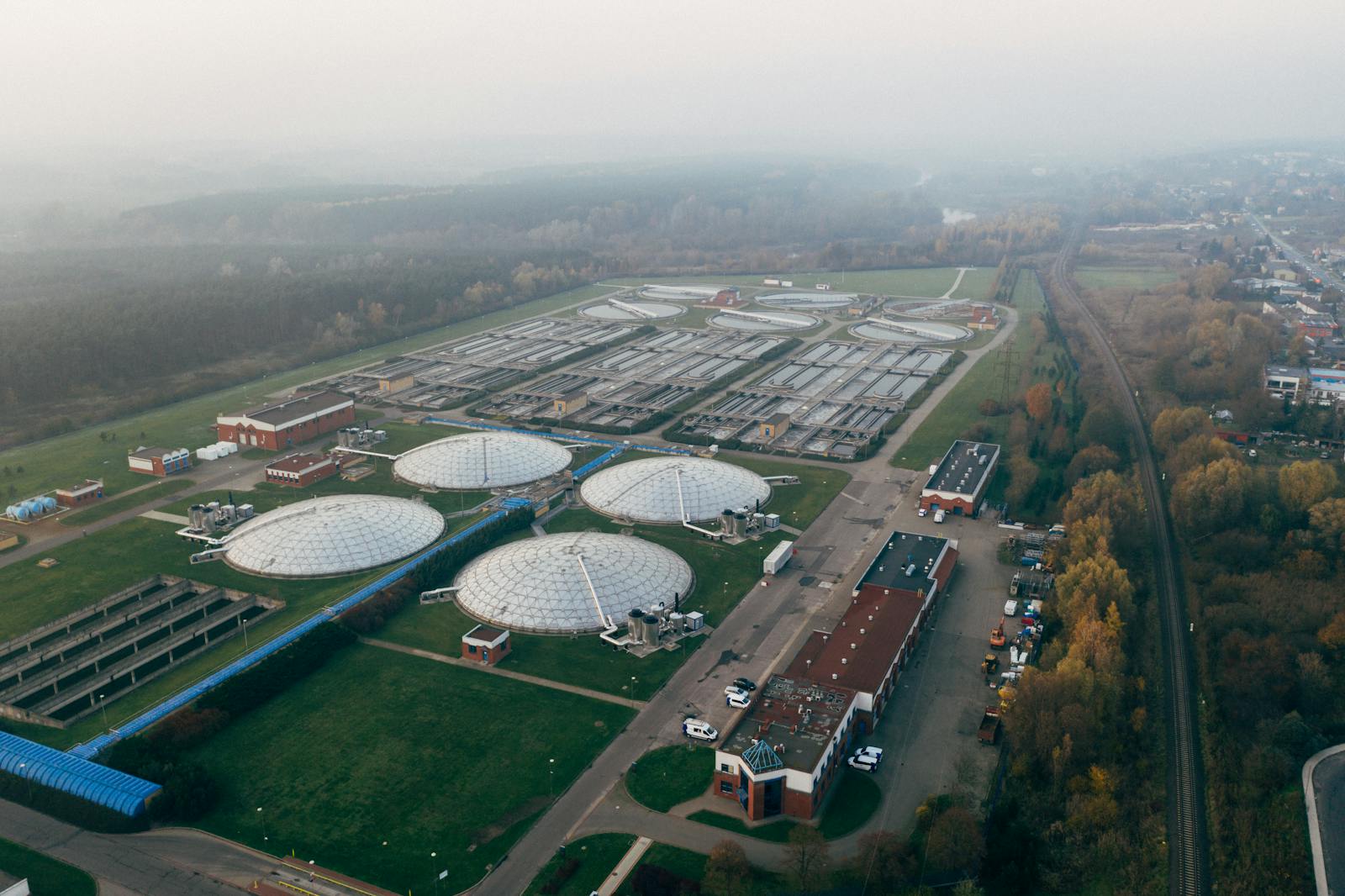
Real sites. Real capture. Not a render of one.
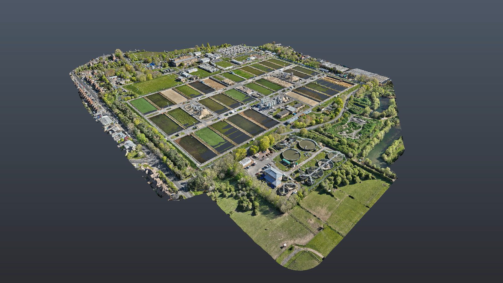
Every Critec 360 twin starts as an actual survey of the actual asset. This is the capture chain on a live water-infrastructure site — flown, modelled and walked.
 01
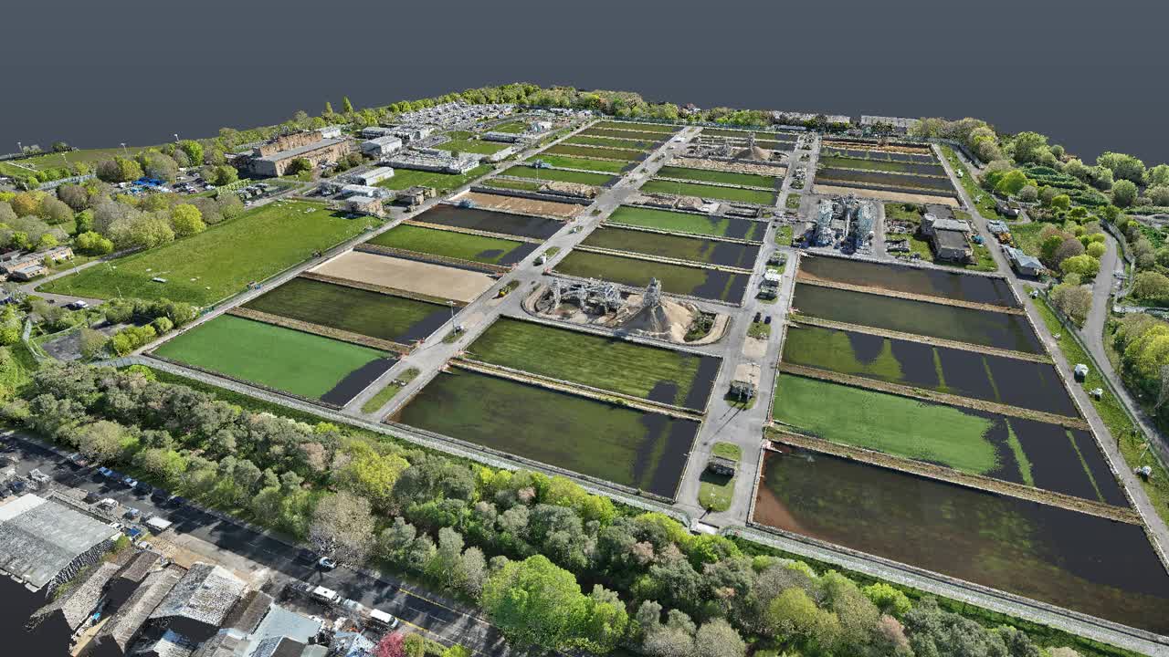
01Drone-LiDAR capture
A single low-disruption flight builds a photoreal, georeferenced record of the whole site — perimeter, compound and rooftop.
 02
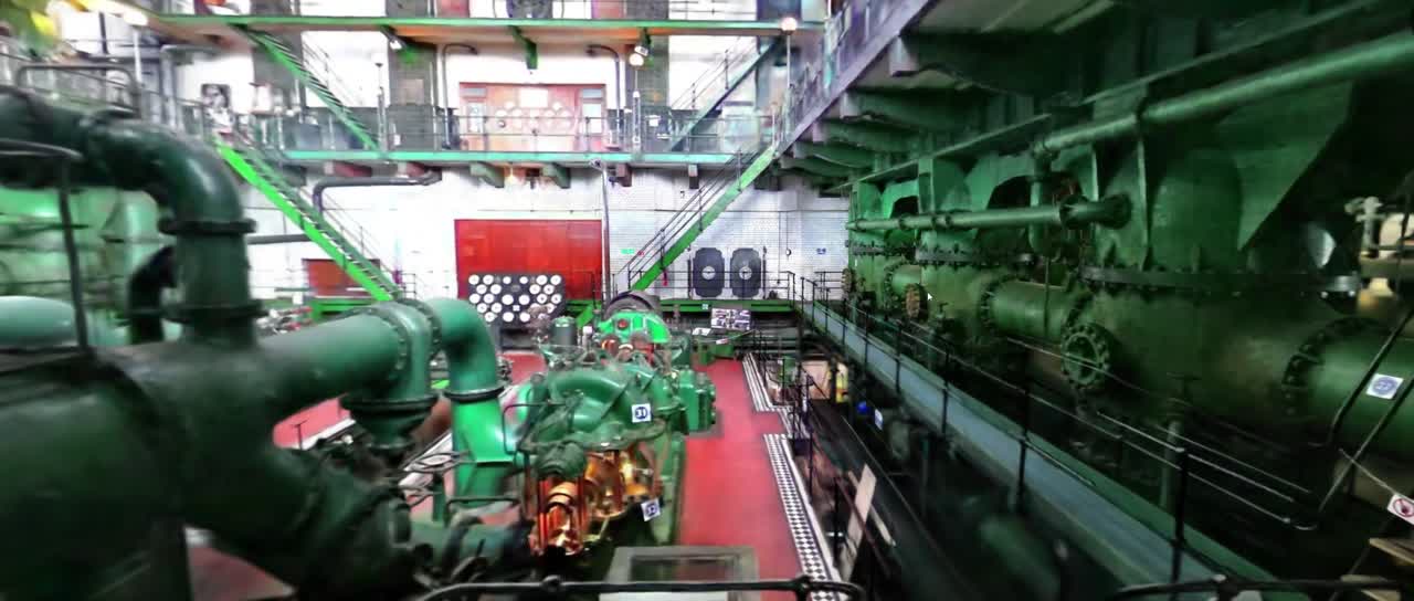
02Gaussian-splat reality model
The capture is rebuilt as a navigable, photoreal twin — masonry, machinery and fine detail held true to life, streamed in a browser.
 03
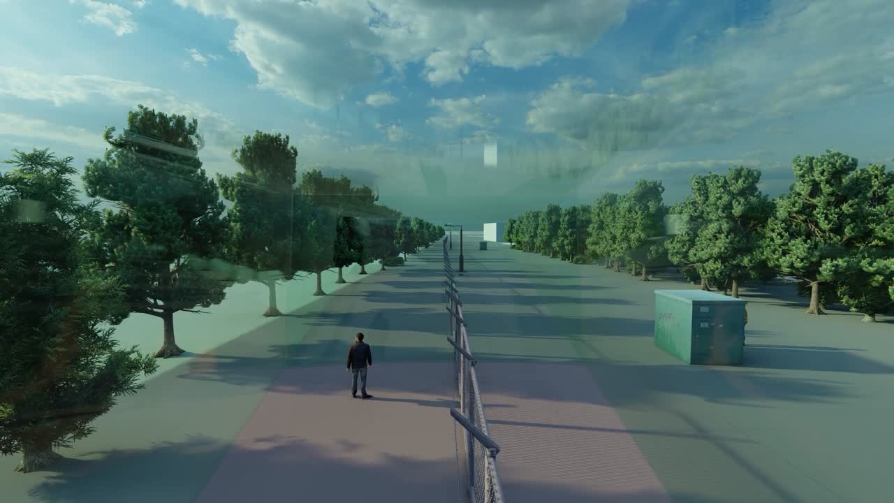
03Navigable digital twin
Walk the modelled scheme end to end — measure, mark up and brief from the same model the board, designer and installer all share.
Survey-grade accuracy, on a model anyone can open in a browser.
- ~0 cm
Measurement accuracy
Survey-grade LiDAR backbone
- 0%
Less hand-modelling
Automation first, engineer QC
- 0+ FPS
In-browser walkthrough
No headset, no plug-in
- 0 px/m
Up to Identify-grade
BS EN 62676-4 coverage
CCTV coverage to BS EN 62676-4 · pixels per metre at the target
Someone is there
What they're doing
Seen them before
Who they are
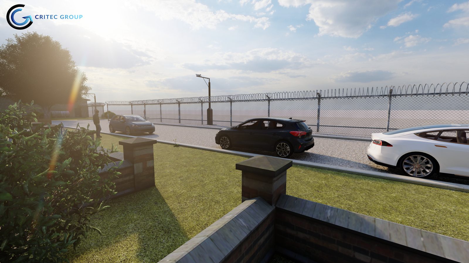
Every camera, justified before procurement.
Drop cameras onto the twin and read the live viewport and exact coverage at the target — Detect through Identify — against real terrain, masts and sightlines. No blind spots, no over-provisioning.
- Live camera viewport from every proposed position
- Detect / Observe / Recognise / Identify bands to BS EN 62676-4
- Caught a sightline fouled by a mast while it's still a drawing
Every finding, tracked to closeout.
The model feeds a live project picture — deliverables, open items, closure rate and criticals roll up automatically, so the programme stays honest from first survey to final sign-off.
- Deliverables, open items and closure rate at a glance
- Stage-gated lifecycle from design to closeout
- Costed, prioritised actions — exported to a branded report
▸ Active project
North Reservoir — Perimeter Upgrade
Total deliverables
across all packages
Open items
out of 108 total
Closure rate
50 / 108 closed
Critical
Cat A defects + major NCs
Project lifecycle
4 / 30 closed
15 / 34 closed
20 / 33 closed
11 / 11 closed
Recent activity
- DRR-204-004Document review — 5 docstoday
- RFI-204-005Analytic license keys for Camera 022d
- OBS-204-004Document register row missing rev field2d
The later it's caught, the more it costs.
The single strongest reason to design security in a model rather than on paper: a clash fixed inside the model costs a fraction of the same fix once crews are on site.
In the model · Design stage
Caught and resolved before a drawing is issued.
Construction docs · Drawings issued
Now it ripples across every affected drawing and schedule.
On site · Installation
The most expensive place, and the worst time, to fix anything.
Source: BIM clash-detection cost studies.
A twin earns its keep before the first site visit.
typical security spend at stake
Prove coverage before you build
Design CCTV viewsheds and detection coverage against the site's real geometry. Close the blind spots — and strip out the over-provisioning — that quietly inflate a scheme. Every camera earns its place against a measurable pixel-density target before a cable is pulled.
less hand-modelling
Compress survey to design
One mobilisation captures both the measurement record and the model you brief from. Automation handles the first pass of turning scan into model; our engineers hold the quality line — turning weeks of manual work into days, without losing survey-grade accuracy.
model everyone shares
One model, every stakeholder
Boardroom, designer, installer and regulator all work from the same twin — measurable, navigable and photoreal. No more reconciling a point cloud against a render against a marked-up PDF.
National infrastructure. Public sector. Private enterprise.
Sector 01
National Infrastructure
Securing the systems the country runs on.
Sector 02
Public Sector
Protecting people, places and the public realm.
Sector 03
Private Sector
Reducing business, asset and reputational risk.

Go deeper on the capabilities.

Independently audited.
Industry-recognised.
Every Critec engagement is delivered to ISO 9001 quality, under BRE SABRE principles, and backed by independent verification across the utilities supply chain and the United Nations procurement system.

LPCB SABRE Licensed Company
SLC-002 · BRE Global

Threat & Risk Assessment
LPCB SABRE · SLC-002-001

Security Engineering & Design
LPCB SABRE · SLC-002-001
ISO 9001 Quality Management
British Assessment Bureau · UKAS 8289

Cyber Essentials Certified Plus
NCSC scheme

BREEAM Accredited Professional
BRE Global · Sustainable built environment

Achilles UVDB Silver Plus
Utilities supplier verification
Achilles UVDB Audited
Site-audited supplier status

Achilles UVDB Verified
Verified supplier qualification

Association of Security Consultants
ASC member

United Nations Global Marketplace
UNGM registered supplier
Coverage rigour. AR verification. On a survey-grade twin.
Camera-design tools lay coverage out on a flat floor plan that knows nothing of real terrain, occlusion or sightlines. Reality-capture platforms build a beautiful twin of the building, then stop at security's front door. Critec 360 closes that gap — it works out viewshed and pixel-density compliance inside a survey-grade, photoreal capture of the actual site, and it is shaped around the obligations CNI operators carry, not retrofitted from a construction tool.