The digital twin.
Three captures, registered into one model you can measure, design against and audit — the metric backbone, the photoreal surface and the engineering frame, locked together.
Three captures, one truth.
The measurement backbone
Drone & SLAM LiDAR
A multi-sensor capture fuses LiDAR, panoramic vision and motion tracking into one coloured point cloud — the metric truth everything else is anchored to.
- A few millimetres of error, not the centimetres a tape and clipboard leave behind
- Hundreds of thousands of points a second, georeferenced to the site grid
- Reads in daylight or complete darkness — it carries its own light
- Exports to LAS / LAZ / E57 for any engineering pipeline
The photoreal surface
Gaussian splatting (3DGS)
Millions of soft, semi-transparent points rebuild the site exactly as it looks — the thin, shiny and tangled detail that meshes and bare point clouds throw away — and it streams in a browser in real time.
- Holds razor wire, masts, fences and cabling true to life
- Photoreal walkthrough at over 100 frames a second, no plug-in
- Locked to the LiDAR — it borrows the cloud's accuracy, it never invents a dimension
- Re-fly the site and the twin shows exactly what changed
The engineering frame
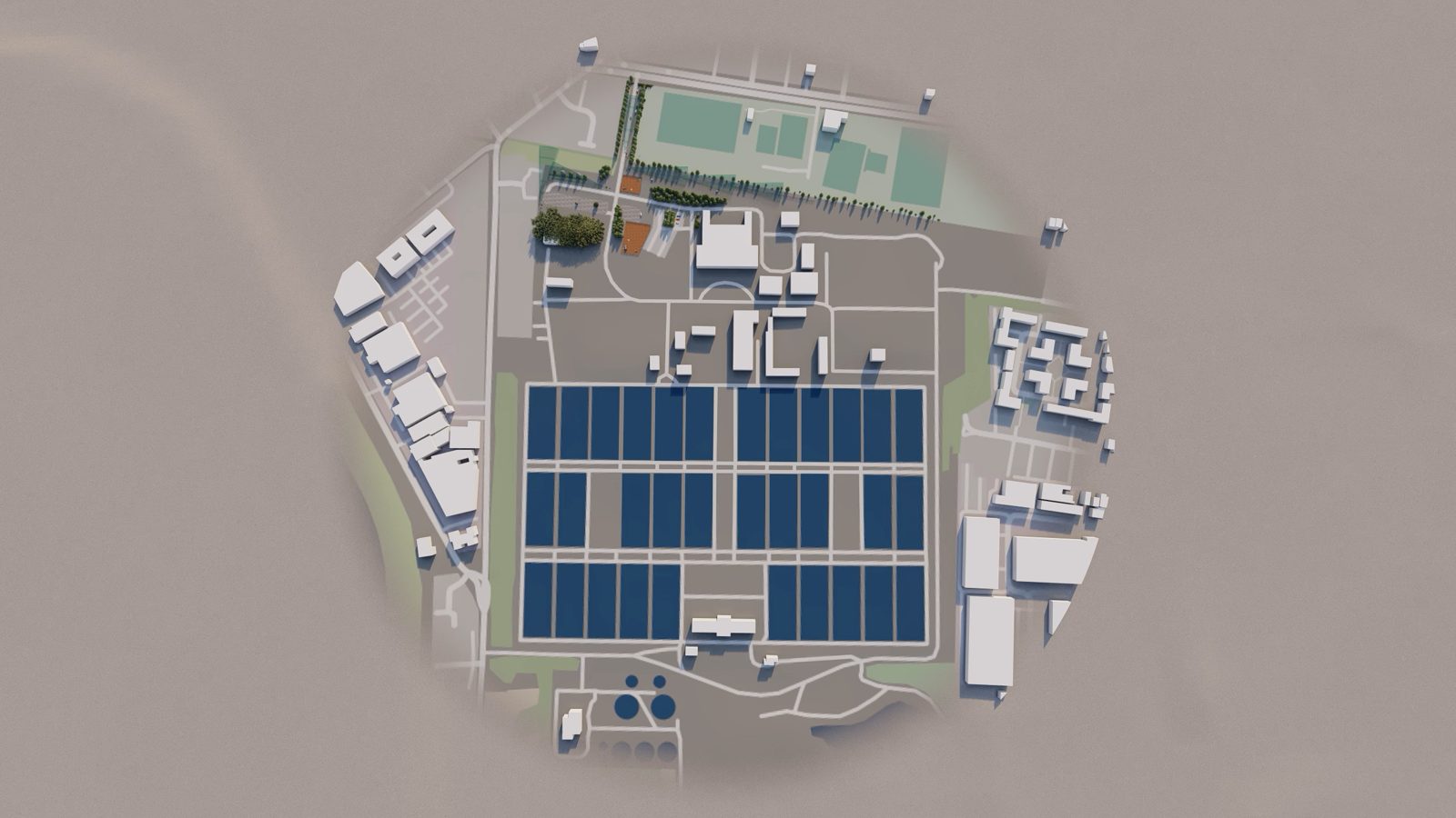
Engineered site plans
Drawn, switchable layers tie the captured reality back to the disciplines that govern it — boundary, grid, buried services and the security design — to UK drawing standards.
- Building line, setting-out grid and red/blue boundary
- Buried utilities coloured to the Street Works UK convention
- Security & CCTV layer to BS EN 62676-4
- Drawn to BS EN ISO 128 / 5455 / 7200, with PAS 128 quality levels
Three captures, one truth.
On their own each is half a picture: a point cloud you can measure but can't read, a splat you can read but shouldn't measure, a drawing that is neither. Held against one another they describe the site as it genuinely is — something you can measure, walk through and trust at the same moment. That is the gap between a survey and real understanding: one model the board can tour, the designer can build in, and the auditor can sign against.
Every way to survey a site, feeding one twin.
Every available method feeds one continuously updated digital twin — far more than a traditional 2D visual could ever carry.
Point cloud
High-density static and handheld scanning, with point-cloud data extracted for measurement and modelling.
Mobile mapping
Vehicle- and backpack-mounted SLAM (Leica Pegasus-class) captures large sites fast, on the move.
Land survey & 360°
Control survey and 360° imagery tie the capture to the site grid and fill the detail between scans.
UAV survey
Fixed-wing and multirotor drones cover topography, roofs and perimeter from the air in a single sortie.
Reality captured, modelled and understood.
Six stages take a site from raw capture to intelligent information — the pipeline behind every Critec 360 twin.
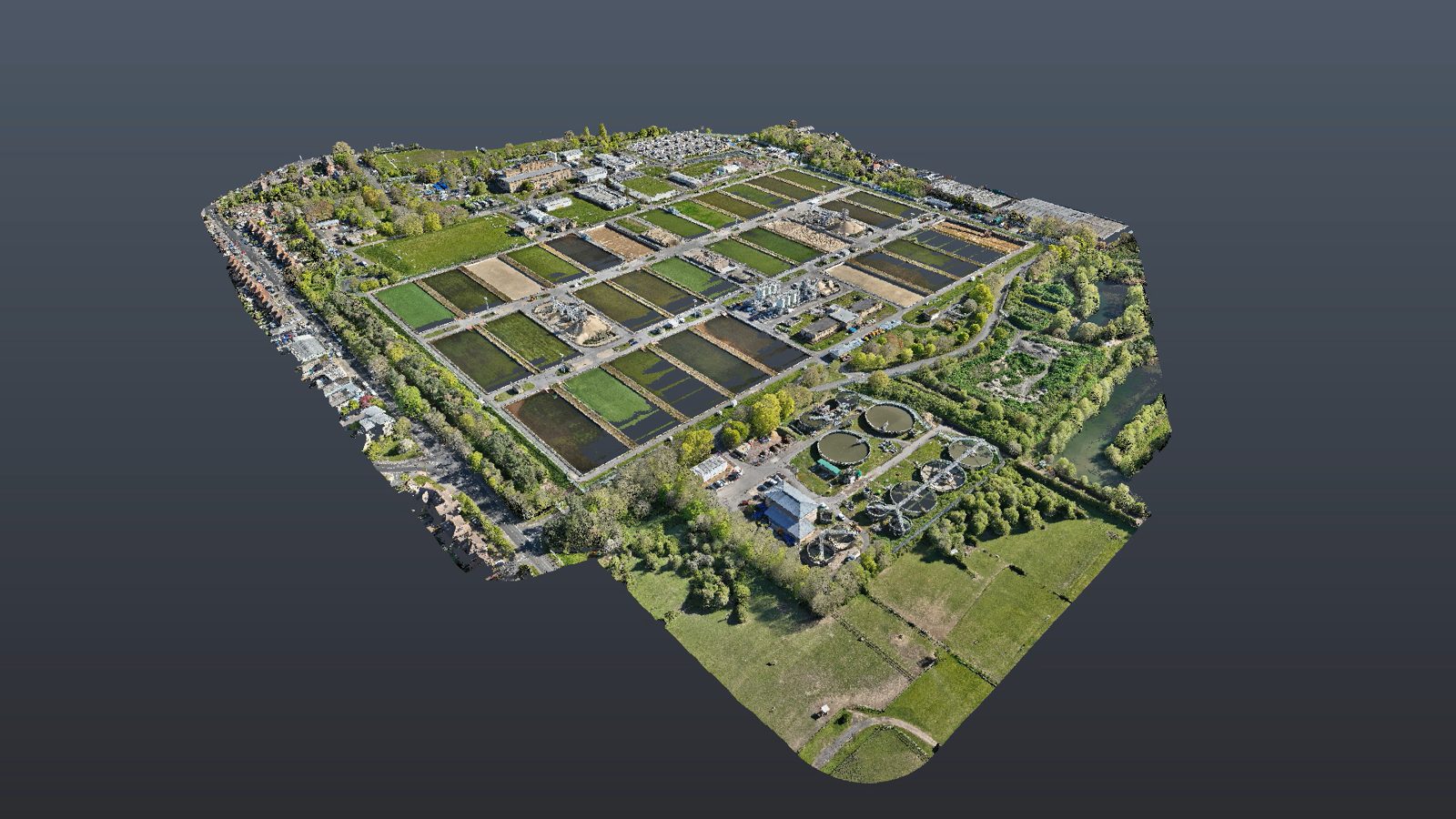
Scans & 3D surveys
Drone and mobile capture, 360° scanning and live footage gather the site exactly as it stands.
Topography extracted
A 3D surface is pulled from the capture — the ground truth everything else is registered onto.
Point cloud
Scanned data is resolved into a dense, measurable cloud of georeferenced points.
Processed data
The cloud is cleaned, registered and broken into the working data files the model is built from.
Security design model
Cameras, detection, hardening and containment are designed in 3D against the real geometry.
Schedules, BOM & registers
Intelligent information — counts, quantities and asset registers — drops straight out of the model.
The benefits of point-cloud surveying.
Capturing with point-cloud hardware instead of a traditional 2D survey gives faster, more accurate site data — and it compounds all the way through design.
- 0%
Reduction in cost
- 0%
Less design-build time
- 0%
Less rework
- 0%
Visible geometry per scan
- 0%
Quicker capture vs manual
Figures based on typical AEC workflows.
One scan. Everything you would have driven back for.
Measure anything, remotely
Lengths, heights, areas and clearances pulled straight off the twin to a few millimetres. Take the dimension you forgot from your desk instead of driving back to a vetted, escorted site.
Cable & containment runs
True 3D route lengths for CCTV and intruder-detection cabling, tray and conduit — read off the model against real visuals, not paced out or scaled from a flat plan.
Part lists & quantities
Cameras, sensors, poles, fence runs, ducting and brackets counted into a costed bill of materials — take-off accurate enough to tender against, even where the record drawings are decades stale.
Clearances & fit checks
Will the mast, cabinet or HVM block actually fit and stand off correctly? Check headroom, gate widths and equipment-removal routes before anyone mobilises.
Volumes & groundworks
Cut-and-fill and material volumes read straight from the cloud for foundations, bunds and trenching — to within a few percent, without putting a crew on dangerous ground.
Fewer site visits
Run design reviews, clash checks and measurement from the desk. On a secured site every avoided visit is one less escort, vetting and permit — not just travel saved.
Prefabrication
Accurate as-built dimensions let brackets, mounts and assemblies be made offsite to drop in first time — measure in the model, build in the workshop.
Safe, permit-light capture
Live, hazardous or restricted areas — substations, vaults, pump chambers — captured from a short visit, often without sending a person into the danger zone at all.
A defensible record
A time-stamped, photoreal as-built that freezes the site in time — for compliance, handover and facilities management, and as objective, hard-to-argue evidence if a dispute ever arises.
Capture, model, design and report — in one place.
Drone-LiDAR capture
Rapid, low-disruption survey of live operational sites — perimeter, compound and rooftop — in a single visit.
Gaussian-splat reality model
A photoreal, navigable twin of the asset as found, ready to share in any browser.
Switchable infrastructure layers
Turn 2D plan, power, water, fire, lighting, telecoms and security on or off independently over the live model.
CCTV viewshed & coverage
Place cameras on the twin and read exact detection-to-identification coverage against BS EN 62676-4 pixel-density targets.
As-built vs as-designed
Lay the design over the capture to catch clashes early — sightlines fouled by masts or foliage, HVM crossing buried services.
Costed, branded reporting
Roll findings into a prioritised, costed remediation plan and a fully-formatted Critec report at the click of a button.